


SEWARD Voting District, Kendall County, Illinois
About
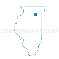
Outline

Summary
| Unique Area Identifier | 571820 |
| Name | SEWARD Voting District |
| County | Kendall County |
| State | Illinois |
| Area (square miles) | 35.11 |
| Land Area (square miles) | 34.97 |
| Water Area (square miles) | 0.14 |
| % of Land Area | 99.61 |
| % of Water Area | 0.39 |
| Latitude of the Internal Point | 41.50478010 |
| Longtitude of the Internal Point | -88.31894550 |
Maps


Graphs
Select a template below for downloading or customizing gragh for SEWARD Voting District, Kendall County, Illinois


Neighbors
Neighoring Voting District (by Name) Neighboring Voting District on the Map
- AUX SABLE 2 Voting District, Grundy County, IL
- AUX SABLE 3 Voting District, Grundy County, IL
- CHANNAHON 7 Voting District, Will County, IL
- KENDALL 4 Voting District, Kendall County, IL
- LISBON Voting District, Kendall County, IL
- NA AU SAY Voting District, Kendall County, IL
- NA-AU-SAY 2 Voting District, Kendall County, IL
- NA-AU-SAY 4 Voting District, Kendall County, IL
- PLAINFIELD 45 Voting District, Will County, IL
- SARATOGA 2 Voting District, Grundy County, IL
- TROY 1 Voting District, Will County, IL
- TROY 10 Voting District, Will County, IL
- TROY 11 Voting District, Will County, IL
- TROY 17 Voting District, Will County, IL
- TROY 28 Voting District, Will County, IL
Top 10 Neighboring County Subdivision (by Population) Neighboring County Subdivision on the Map
- Plainfield township, Will County, IL (80,318)
- Troy township, Will County, IL (45,991)
- Aux Sable township, Grundy County, IL (13,061)
- Channahon township, Will County, IL (10,322)
- Na-Au-Say township, Kendall County, IL (8,145)
- Kendall township, Kendall County, IL (7,739)
- Saratoga township, Grundy County, IL (6,122)
- Seward township, Kendall County, IL (4,455)
- Lisbon township, Kendall County, IL (899)
Top 10 Neighboring Place (by Population) Neighboring Place on the Map
Top 10 Neighboring Elementary School District (by Population) Neighboring Elementary School District on the Map
- Troy Community Consolidated School District 30C, IL (36,786)
- Minooka Community Consolidated School District 201, IL (23,634)
- Channahon School District 17, IL (10,196)
- Saratoga Community Consolidated School District 60C, IL (5,979)
- Lisbon Community Consolidated School District 90, IL (883)
Top 10 Neighboring Secondary School District (by Population) Neighboring Secondary School District on the Map
- Joliet Township High School District 204, IL (128,595)
- Minooka Community High School District 111, IL (38,032)
- Morris Community High School District 101, IL (18,332)
- Newark Community High School District 18, IL (3,549)
Top 10 Neighboring Unified School District (by Population) Neighboring Unified School District on the Map
- Plainfield School District 202, IL (120,091)
- Oswego Community Unit School District 308, IL (75,151)
- Yorkville Community Unit School District 115, IL (28,319)
Top 10 Neighboring State Legislative District Lower Chamber (by Population) Neighboring State Legislative District Lower Chamber on the Map
- State House District 84, IL (202,008)
- State House District 50, IL (178,899)
- State House District 75, IL (125,585)
Top 10 Neighboring State Legislative District Upper Chamber (by Population) Neighboring State Legislative District Upper Chamber on the Map
- State Senate District 42, IL (337,625)
- State Senate District 25, IL (332,979)
- State Senate District 38, IL (231,284)
Top 10 Neighboring 111th Congressional District (by Population) Neighboring 111th Congressional District on the Map
Top 10 Neighboring Census Tract (by Population) Neighboring Census Tract on the Map
- Census Tract 8907, Kendall County, IL (15,257)
- Census Tract 8804.20, Will County, IL (10,373)
- Census Tract 8832.15, Will County, IL (10,210)
- Census Tract 8906, Kendall County, IL (9,414)
- Census Tract 1.02, Grundy County, IL (7,415)
- Census Tract 2, Grundy County, IL (6,648)
- Census Tract 8832.13, Will County, IL (5,519)
- Census Tract 8832.12, Will County, IL (5,393)
- Census Tract 8833.03, Will County, IL (3,705)